PortDB
We helped the United Kingdom Hydrographic Office (UKHO) build PortDB, a web portal which displays maritime related geospatial data such as berths, dredged areas, restrictions, and many more. The geospatial data is stored in a PostgreSQL database and rendered using Mapbox GL JS, a JavaScript library that uses WebGL to render interactive maps from vector tiles and Mapbox styles.
We used completely open source tools to build this platform. It’s hosted using an Amazon EC2 server running Linux Ubuntu.
We used AngularJS to build the front-end application and MapBox GL JS to render the map. For the back-end system we built a PHP API which interacts with a PostgreSQL database which stores the user authentication data along with some of the geospatial data.
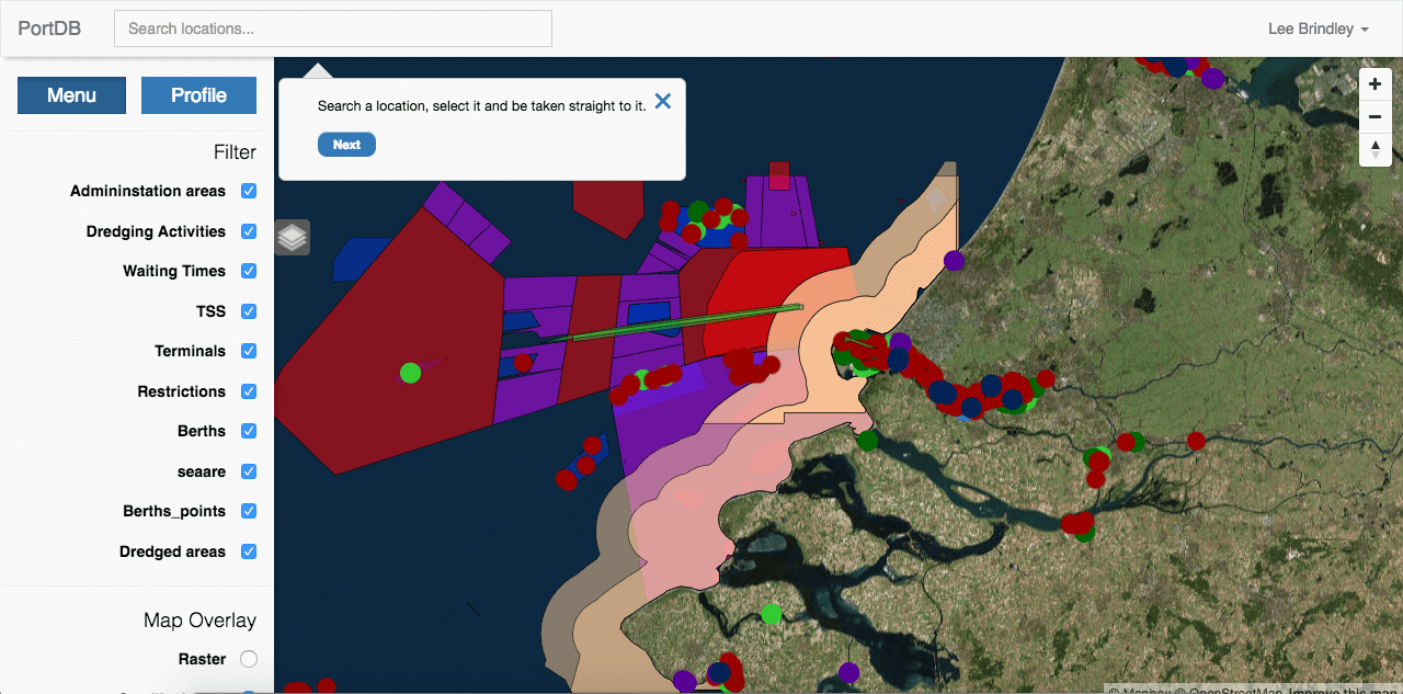
Map Filter
PortDB has a filter whereby the user can choose what should be displayed to them on the map. They can also this filter to switch between a raster map layer or a satellite image.
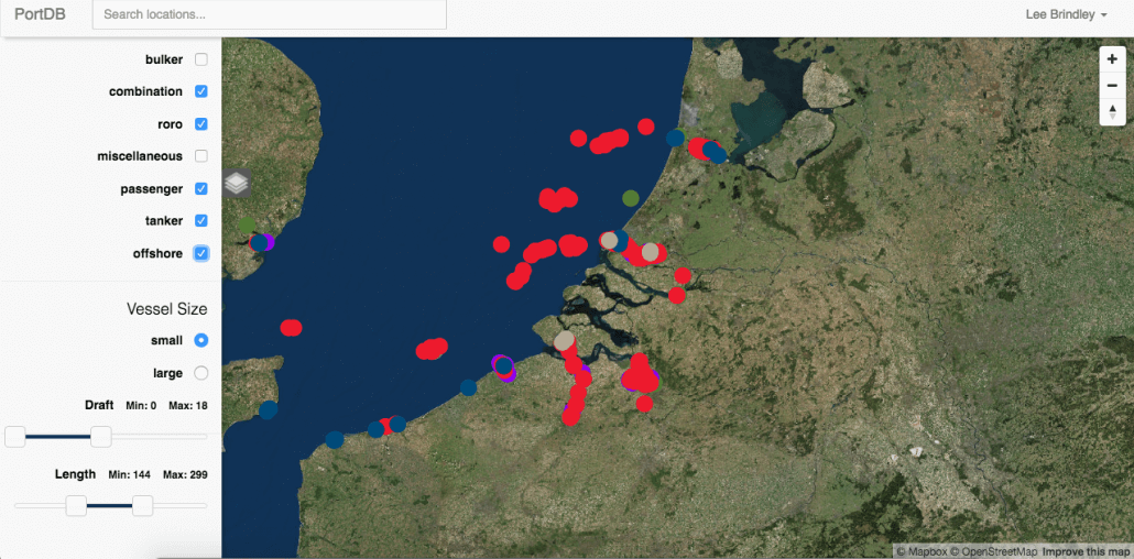
User Profile
We implemented a user profile in PortDB which allows the user to define a profile about themselves. This was designed so that, if a user was responsible for sailing a tanker, then they could opt to only show relevant geospatial data for tankers on the map. The profile also allows the user to define the vessel size, draft size, and length of their vessel to further tailor the data displayed to them.
Site Tour
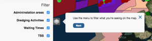
PortDB has a “tour” which we built using AngularJS. This function gives the user a tour of the web portal showing them all of the key features that they can use.
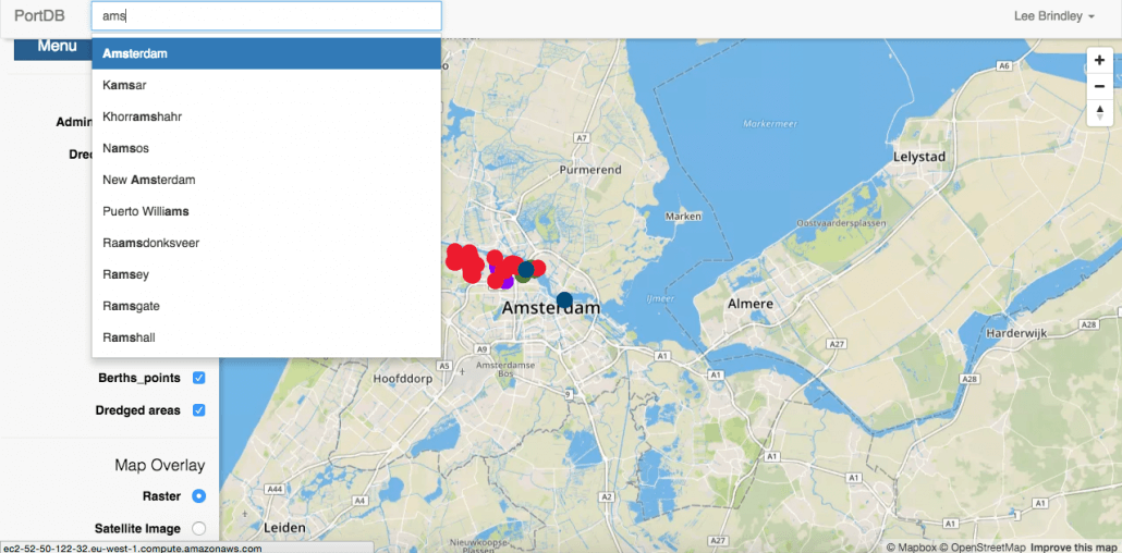
“Typeahead” Location Search
We implemented a “typeahead” search function for PortDB. As the user types into the location search bar we send Ajax JavaScript requests from our Angular app to the PHP API which then queries the PostgreSQL database for any ports matching the text the user input. Upon clicking on a search result the map then pans to the desired location.
About PortDB
Technologies used:
- Angular
- Also used for...
- Care Hero Shift Booking
- PortDB
- Maritime Information Portal
- Geospatial Data
- Also used for...
- Launch Tide
- Intelyse Platform
- PortDB
- JavaScript
- Also used for...
- Lyme Regis Golf Club
- Sinar TXM
- Launch Tide
- PHP
- Also used for...
- Breast Reconstruction: Your Choice
- All Your Horse Needs
- WeFunction
- PostgreSQL
- Also used for...
- PortDB
- Maritime Information Portal
Who worked on this project?

Latest on Facebook
Happy Holidays from Blaze!
Wishing all our clients a great festive period no matter how you are celebrating. We are now shut down to get some well needed rest after a busy year. We look forward to working with you for a bright 2024. I don’t think any of us are quite ready to take Santa's place just yet.

1 CommentComment on Facebook
Happy Holidays!! May the New Year bring you Health, Happiness and Success in abundance! 🥰


