Launch Tide
We worked with the staff of the R&D department of the United Kingdom Hydrographic Office (UKHO) to create the Launch Tide app, which is an iOS and Android app the UKHO designed in collaboration with the RNLI, to assist RNLI rescue staff with the provision of key tidal, weather, and sea state data, describing the current, and future conditions of their set stations and beaches.
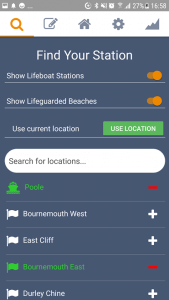 Launch Tide allows RNLI staff to register an account, search for their relevant RNLI stations and beaches, either using a text search, or through utilising the device’s GPS sensory unit, to return a list of the nearest stations / beaches which are closest to the user’s device. The user can then view and interact with the key tidal, weather, and sea state conditions, based on their current set location.
Launch Tide is a JavaScript hybrid mobile app, which was built using the React Native framework. Interaction with mobile sensors is performed within the app, i.e. using interfaces to provide a bridge between the JavaScript application code, and the underlying native sensor APIs, exposed by the device’s operating system.
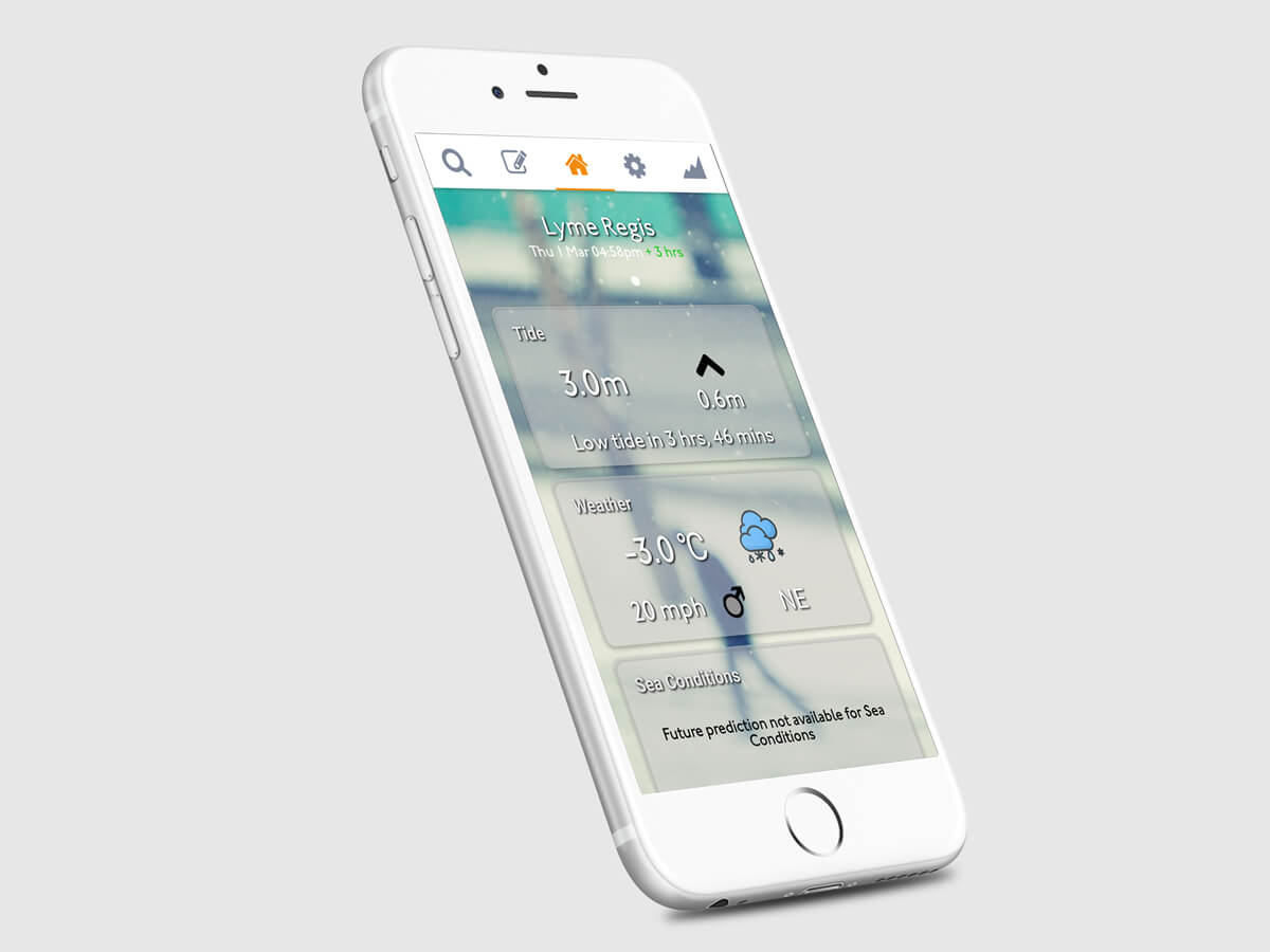
Conditions Screen
The conditions screen does what it says on the tin, it displays the following data, which provide an insight into the weather conditions at the user’s location, for the current time, and it provides a look-ahead feature, whereby if you swipe right, the data values will change to display the condition predictions in the following 3 hours, i.e. you’re looking ahead to what the conditions will be like in the next 3 hours – a potentially critical feature for ensuring the safety of the RNLI crew when on long rescues.
The data on the conditions screen is broken down into three cards:
Tide
The tide card shows the current height of the tide, the time until the next turn in the tide, i.e. high tide / low tide, as well as the expected height of the tide at the next scheduled turn.
The look ahead feature is enabled for this card, allowing the user to see what the tide state will be like in the next 3 hours.
Weather
The weather card shows the temperature, wind speed, and wind direction.
The look ahead feature is also enabled for this card, allowing the user to see what the weather will be like in the next 3 hours.
Sea State
The sea state card shows the current wave height, sea temperature, and wind direction in the area, essential data for an RNLI rescue mission!
Tide Predictions Screen
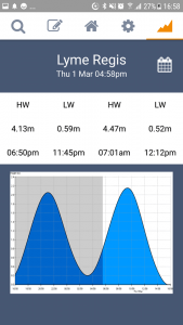 The tidal prediction screen allows the user to interact with UKHO’s tidal prediction API, to browse the tidal prediction data, based on their set current location.
The app allows users to choose a date, which defaults to the current time, this date is then passed to two of UKHO’s tidal prediction API functions – one which returns a set of information, detailing the next 4 changes in tide (high tide / low tide).
The second function from UKHO’s tidal prediction API returns a dynamically rendered PNG graph, this graph visualises the changes in tide in a graph, with the app allowing the user to pinch to zoom the image to get a close-up view of what the tide height prediction is for a given time.
Changing the date using the calendar icon at the top-right of this screen will trigger the screen to automatically update with UKHO’s tidal prediction API, and therefore allows the user to seamlessly view both current and future tide predictions for their current location.
About Launch Tide
Technologies used:
- Geospatial Data
- Also used for...
- Launch Tide
- Intelyse Platform
- PortDB
- JavaScript
- Also used for...
- Lyme Regis Golf Club
- Sinar TXM
- Launch Tide
- React Native
- Also used for...
- Sinar TXM
- Launch Tide
Who worked on this project?
Latest on Facebook
Happy Holidays from Blaze!
Wishing all our clients a great festive period no matter how you are celebrating. We are now shut down to get some well needed rest after a busy year. We look forward to working with you for a bright 2024. I don’t think any of us are quite ready to take Santa's place just yet.

1 CommentComment on Facebook
Happy Holidays!! May the New Year bring you Health, Happiness and Success in abundance! 🥰


